Looking for more amazing hikes in the Lauterbrunnen Valley?
Try hiking from Wengen to Leiterhorn, or check out a whole range of options in my post “Hiking in Switzerland’s Beautiful Lauterbrunnen Valley”.
LOCATION
Grütschalp, the starting point for this hike, is easily accessible via cable car from the village of Lauterbrunnen in Switzerland’s Lauterbrunnen Valley. The town of Lauterbrunnen is a 30-minute train ride south of Interlaken.
LENGTH
~9 miles one way — Since I couldn’t find a map mirroring my exact route, this is an estimation.
DIFFICULTY
Moderate/Challenging — Much of the trail from Grütschalp to Sulwald is uphill, but it isn’t too steep overall. There are a few brief steep sections, and some muddy spots. Before reaching Sulwald, you will traverse a rugged clifftop ridge for a short distance. There are some steep downhill segments here, but a cable connected to the rock wall helps ease the way. The downhill trail between Sulwald and Isenfluh is steep, but you can skip this section by taking the little cable car that connects these two villages.
CURRENT INFO
As is so often the case with these Alpine hikes, I had a hard time finding a map replicating my route online. Luckily, this route on AllTrails mirrors my trek from Grütschalp to Sulwald. Just keep in mind that I hiked this in reverse, starting at Grütschalp and heading to Sulwald. From Sulwald, I followed the zigzagging switchback trail to Isenfluh, then followed the road out of town to Lauterbrunnen (the road is actually a pedestrian and bike path for most of the way).
For general information on planning a trip to the Lauterbrunnen Valley, I recommend Rick Steves’ Switzerland guidebook.
I HIKED IT
July, 2023, about 4.5 hours (I recommend allowing 5 to 6 hours unless you are a fast hiker)

GOOD TO KNOW
- This is a great hike if you want to leave the crowds behind. Most visitors in the Lauterbrunnen Valley focus on the hikes near Mürren or the trail from Männlichen to Kleine Scheidegg. Few venture toward lesser known Sulwald and Isenfluh.
- Public toilets are available in Grütschalp at the start of the trail. You may also find toilets available at the cable car stations in Sulwald and Isenfluh.
- This hike starts with a cable car ride from Lauterbrunnen to Grütschalp (unless you are staying in Gimmelwald or Mürren, in which case you can take the train to Grütschalp). Tickets can be purchased with cash or credit card in the cable car station in Lauterbrunnen. The cable car station is located across the street from the Lauterbrunnen train station.
- Bring water. There are a few places along the trail where you may be able to refill your bottle, but not many.
- Wear hiking shoes or boots with good traction. Hiking poles are recommended, but not required.
- Much of the route to Sulwald and Isenfluh follows a forested trail. Be prepared for lots of rocks and roots on the trail in some sections. A few sections are more exposed, particularly the stretch along the rocky canyon wall above the Sousbach River. The latter part of the trail follows a paved road into Lauterbrunnen, but is closed to car traffic.
- You can skip about a mile of downhill switchbacks between Sulwald and Isenfluh by taking the cable car that connects these villages.
- There are several benches located along the trail, ideal for a snack break or simply enjoying the views.
- Dreaming of Alpine cheese (Alpkäse)? Carry some cash, as you just may pass a couple of milk barrels along the trail with cheese for sale.
- Always follow Leave No Trace principles.

HIGHLIGHTS
The hike to Sulwald is simply beautiful, with lush, green forest, roaring mountain rivers, and glimpses of high Alpine peaks above verdant meadows. It’s made all the more special by the fact that you won’t encounter many other hikers on the trail. It’s great in any weather, but since mountain views aren’t the primary draw, it’s a good choice on a cloudy day.

THE KIDS’ TAKE
I recommend the hike to Sulwald for kids who are already strong hikers, as the uphill climb at the start can be tiring. Most significantly, the exposed section above the Sousbach River can be treacherous. Young children will require hands-on guidance here, and you may prefer to skip it until they are older.
Many kids will enjoy taking the tiny cable car from Sulwald down to Isenfluh — it’s fun, and you get to skip one of the steepest and arguably less interesting parts of the hike. Check ahead of time to see if one of the restaurants in Sulwald or Isenfluh is open, or pack a fun picnic to share. Don’t forget the Swiss chocolate!

WHILE YOU’RE HERE
There is no shortage of hikes to keep you busy in the Lauterbrunnen Valley. For a range of options, starting with an easy walk along the valley floor, check out my post “Hiking in Switzerland’s Beautiful Lauterbrunnen Valley”. These hikes will take you from Lauterbrunnen to Gimmelwald and Mürren, and I also include tips on taking public transportation if you prefer not to hike. From Mürren, you can take the cable car to the top of the Schilthorn for one of the best views in the Alps.
On the other side of the Lauterbrunnen Valley, try hiking to Leiterhorn from the charming village of Wengen. From Wengen, you can also take the cable car to Männlichen for glorious views along the easy Panorama Trail.
There are a few restaurants in Sulwald and Isenfluh, but they can have unpredictable hours. To pack a picnic, I recommend the Coop grocery store in either Lauterbrunnen or Wengen.
My Experience
Let me start off by saying that hiking in Switzerland is about so much more than mountain views. I can’t even say I was disappointed by the clouds as I headed to the cable car station in Lauterbrunnen, ready to ascend to Grütschalp. This was the starting point for my hike, which would lead from Grütschalp to Soustal, Chüebodmi, Sulwald, and Isenfluh, then finally back to Lauterbrunnen.

Wait, just what are all these places, you may be asking. Good question! We’ll get to that. First, it’s time to board the crowded cable car to Grütschalp. You can buy your one-way ticket from the ticket machine in the station or from the ticket booth. Crowded as it may be, it’s usually possible to get on the next cable car without much of a wait.

Once we reached Grütschalp, everyone shuffled off the cable car and onto the waiting train cars. Everyone, that is, except me. And maybe one other person. Most people don’t stop at Grütschalp, but instead take the train directly to Mürren. But Grütschalp is the starting point for a number of great hikes, including a beautiful trail to Mürren. Today, I was headed in the opposite direction, toward the tiny towns of Sulwald and Isenfluh. After using the very nice (and free) restrooms at the cable car station, I headed up the stairs and behind the café to start the hike.

Not far behind the café, a sign pointed up the hill toward Chüebodmi and Isenfluh. For now, this is the direction you want to follow. Almost immediately after this first sign, another sign pointed for me to turn right. A third sign quickly followed, pointing toward a narrow dirt trail in the grass.

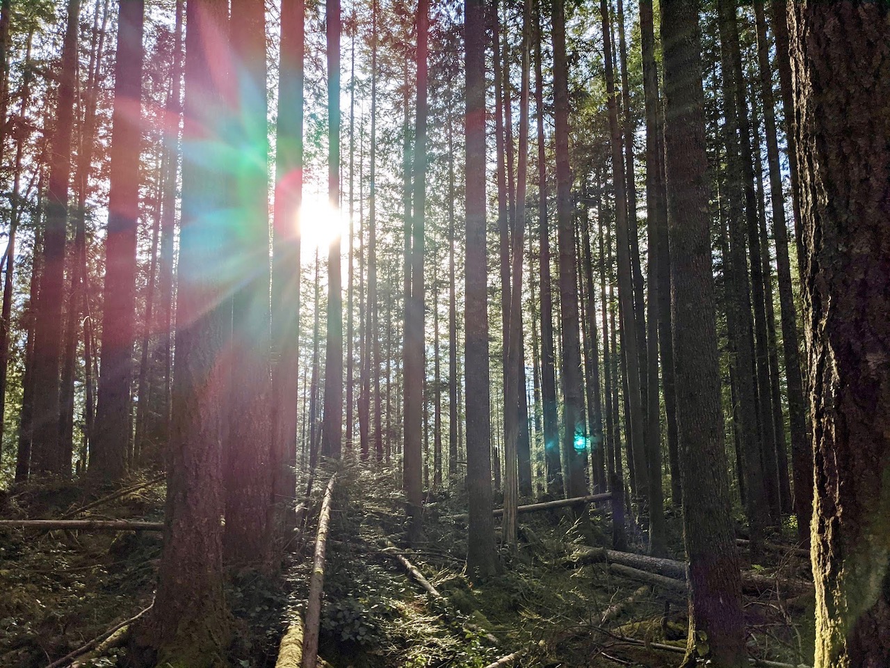
The trail soon entered the forest, where the air was cool and damp. I could hear the sound of machinery working in the distance, but fortunately that wouldn’t last. Raindrops began to fall, and I breathed deep, letting the scent of earth and moss fill my lungs.

It wasn’t long before the rain cleared. Sunlight filtered through the branches overhead, lighting up the brilliant greens of the moss and ferns that lined the trail. I climbed steadily upwards, crossing roots and rocks. At times the trail was steep, but only for a minute or two at a time. For the most part, it followed a steady, slow incline up the hillside.

Eventually, the elevation gain slowed and I found myself looking across meadow dotted with evergreens. Below me, a gravel road wound through the valley toward the Sousbach River. This was Soustal, or Sous Valley, where the Sousbach River roars through a rocky gorge, eager to reach the Lauterbrunnen Valley below. I stopped for a moment by another signpost near a wooden barn, trying to determine the correct trail to continue.
“Kann ich Ihnen hilfen?” asked a friendly voice with what sounded like a German accent. “Can I help you?”
“Ist hier die Weg nach Chüebodmi?” I asked if this was the trail to Chüebodmi, pointing toward a narrow strip of dirt that skirted the barn.

My helpful fellow hiker confirmed that was correct, letting me know I would head down the hill, then turn right, then left before crossing a small bridge. With a happy smile, she waved goodbye as I continued down the trail. I paused to admire the Alp cheese for sale in a milk barrel placed alongside the trail. It looked delicious, but I had no cash with me. I’ll have to remember some for next time!

It was a quick but muddy walk down to the river, where gorgeous views of the Lobhorn Mountain greeted me. Although this was clearly a cow pasture, no cows were to be seen. They were probably in the higher meadows, I assumed. Several large barns dotted the Soustal, and there was a full-on construction site set up along the Sousbach River. Evidently, this is a source for local hydroelectric power, and they were making improvements to the infrastructure.

Crossing the bridge over the Sousbach proved to be a bit tricky, as this area was riddled with mud. That’s one downside to hiking during rainy times, I suppose. With some clever quicksteps I made it across, thankfully without falling face first into the muck.

Leaving the construction site behind, the trail once again entered the forest, but soon opened up to an incredible view of the Sousbach River as it ripped through the valley. With a mighty roar, the river became a waterfall tumbling down the rocks before continuing through the narrow chasm of the canyon. It was an awesome sight, but since the view of the waterfall is obscured, it’s difficult to capture in a photo. Just another reason to visit in person, if you ask me.
I took a few moments to admire its sheer brute force before continuing down the steep, rocky ridge top trail. This section of the trail drops off precariously, and rocks on the path can be quite slippery. I was thankful to have a cable to hold onto during the worst parts.

Back in the woods, I continued on the trail to Chüebodmi. By now I was feeling hungry, so paused for a lunch break on a log that offered a cloudy view of the massive mountains that dominate the Lauterbrunnen Valley — the Eiger, Mönch, and Jungfrau. Even seen from across the valley partially obscured by thick clouds, these mountains never fail to inspire awe.

Soon after lunch, I reached Chüebodmi, which also offers fantastic views of the mountains (and maybe a better place to sit than my aforementioned log). Chüebodmi is, essentially, a scenic cow pasture nestled among the hills. Again, no cows were present, but it’s a beautiful spot to pause for a break. There’s also a water trough with fresh water running behind one of the barns.

I was eager to continue with my hike, so didn’t pause for long. Behind the main barn at Chüebodmi, and past a few not insignificant puddles, the trail leads up to the fence. Here, a sign indicated the way to Sulwald, my next destination. At this point, the uphill climb that had defined so much of the trail thus far was officially over. That’s right, it’s all downhill from here.

It’s a fairly steep descent to Sulwald, and the trail is somewhat rocky, although wide and well-maintained. I found it a refreshing change of pace and quickly made my way down, passing a few other hikers on my way.

Within 20 minutes, I came to Sulwald, a small collection of houses and barns on the hillside. It’s a lovely spot, and a road provides access for cars. As with many small Swiss mountain villages, I assume only those who live and work here, and perhaps some who are renting a place to stay, have permission to drive the road.

Sulwald does have one alternate means of transportation, and that’s the mini cable car that travels from here to the village of Isenfluh below. I haven’t tried it, but it looks absolutely adorable. There was quite a gathering of families outside the cable car station when I came into town. Perhaps they, too, had been out for a hike? Or maybe berry picking? One family I passed shortly before entering Sulwald was eagerly gathering huckleberries from low-growing bushes along the trail.

After passing the cable car station, I headed down the hill and turned right onto a gravel road that led under the cable car lines. The views from here were glorious as well. It wasn’t long before I turned onto another trail leading toward Isenfluh. The gravel path was quite steep, and the views mostly disappeared as it headed through the forest. All in all, it’s not a bad trail, but it is one of the least interesting parts of the hike. If you prefer to spare your knees, you might rather take the cable car.

I made it Isenfluh, where I admired some of the beautiful flower gardens as I passed through town. Like Sulwald, there isn’t much to Isenfluh. There are a few restaurants and pensions, but whether or not any restaurants are open can be unpredictable. I was glad to have brought my own picnic lunch from the Coop grocery store for this hike.

From Isenfluh, a paved road leads out of town. Yes, there can be some cars, but this is Isenfluh we’re talking about, so there won’t be many. Soon, another road, this one looking much more hazardous (don’t worry; it’s just a warning for falling stones), branches off to the right for Lauterbrunnen. This road is now officially a pedestrian and bike route, so you won’t see other vehicles unless they are here for maintenance purposes.

The final stretch toward Lauterbrunnen is wide and easy. You’ll once again cross the Sousbach River as it continues its tubmle to join the Lütschine River in the Lauterbrunnen Valley. As I entered Lauterbrunnen, I felt refreshed and invigorated. Sure, I was a little tired, too, but nothing compared to the weariness I’d experienced after my hike down from Winteregg two weeks earlier.
Throughout the nine-mile hike, I hadn’t seen more than a few dozen people on the trail, but I did see fairy-tale meadows, frothing rivers, charming farm villages, and, yes, stunning mountain views. I even snuck some huckleberries on a few occasions. For a cloudy-day Swiss hike, the hike from Grütschalp to Sulwald couldn’t be beat.


