Welcome to Switzerland’s magical Lauterbrunnen Valley!
From easy paved walks to challenging climbs, there are hikes here to suit outdoor-lovers of all abilities. Look below for ideas on how to incorporate a hike or two (or three or four) as you explore the valley from Lauterbrunnen to Gimmelwald, Mürren, and beyond.
Looking for even more hikes in Lauterbrunnen Valley?
Check out these hidden gems, including a wonderful hike from Wengen to Leiterhorn and an adventurous trek from Grütschalp to Sulwald.
LOCATION
The Lauterbrunnen Valley is located in Switzerland’s Berner Oberland region. The small town of Lauterbrunnen is the valley’s transportation hub, where this loop hike starts and ends. Lauterbrunnen is a 20-minute train ride south of Interlaken.
I HIKED IT
July, 2023, about 7 hours to do the full loop on foot, including breaks, but you can break this trip into much shorter hikes and use cable car, bus, and train connections to complete the loop
CURRENT INFO
Trail reports and maps covering different variations of these hikes are available on the AllTrails website. To plan your trip to Switzerland and the Lauterbrunnen Valley, I recommend Rick Steves’ Switzerland guidebook.

LENGTH/DIFFICULTY
This loop can easily be broken into five separate hikes. No need to do all of it on foot — pick the trail or trails you prefer and let the bus, train, and cable car connections take care of the rest. Three of the hikes are easy, while the other two are much more challenging. A brief introduction with the most important details for each option is listed below. To view photos and read a full description of my experience hiking each segment, click on the title for each hike.
Special note: I tend to hike fairly fast when on my own. Because of this, I decided to include both my personal hiking time and the time I recommend average hikers allow for each hike. If you’re an accomplished athlete, you may find you hike these trails more quickly. But for the rest of us mere mortals, it’s better to plan for a longer hike. And if it takes you even longer than my recommended time, that’s OK, too. It’s all about enjoying the experience at your own personal pace.

VALLEY WALK FROM LAUTERBRUNNEN TO STECHELBERG
- Highly recommended — This easy walk is a fun way to explore the Lauterbrunnen Valley. Watch for waterfalls as you go. It’s also a great rainy day option.
- 2.3 miles from Lauterbrunnen to Trümmelbach Falls, 3.2 miles to the Schilthorn cable car, or 3.5 miles to Stechelberg
- Easy — The trail is mostly paved and flat, with a gentle uphill section near the beginning.
- From Lauterbrunnen, allow 45-60 minutes to Trümmelbach Falls, 1.5-2 hours to reach the Schilthorn cable car station, and a little longer to the end of the trail in Stechelberg. I hiked the full trail in roughly an hour.
- Alternative transportation — Take the post bus from Lauterbrunnen, which makes stops at Trümmelbach Falls and the Schilthorn cable car station, as well as other places along the valley floor.

STECHELBERG TO GIMMELWALD
- Recommended with reservations — If you’re up for a steep hike with a few beautiful hidden waterfalls, this one’s for you. Otherwise, take the cable car.
- 2 miles one way
- Challenging — This trail is primarily a long series of steep switchbacks. It’s well maintained, with stair steps built into the natural trail for much of the hike. Hiking poles are recommended when hiking downhill from Gimmelwald to Stechelberg.
- From Stechelberg, allow 2 hours to reach Gimmelwald. This is the uphill route, and it took me 1.5 hours starting from the Schilthorn cable car station. Downhill may be a bit faster, but also harder on the knees.
- Alternative transportation — A cable car connects Stechelberg and Gimmelwald, and is definitely the easiest way to travel between the two.

GIMMELWALD TO MÜRREN
- Recommended — The downhill option from Mürren to Gimmelwald is accessible for many, and offers some great views and the chance to explore both villages.
- 2 miles from the Gimmelwald cable car station to the Mürren train station (a little less to the Mürren cable car station)
- Easy/Moderate — The easiest option is to walk downhill from Mürren to Gimmelwald. The trail is wide and paved, but there are some switchbacks and it’s a steady uphill incline coming from Gimmelwald.
- Allow one hour if hiking uphill from Gimmelwald to Mürren, or 45 minutes when hiking downhill from Mürren to Gimmelwald. I hiked from the cable car station in Gimmelwald to the train station in Mürren in around 45 minutes.
- Alternative transportation — Take the cable car between Gimmelwald and Mürren if you prefer not to walk.

MÜRREN TO WINTEREGG OR GRUTSCHALP
- Recommended — This easy hike offers great views of the Eiger, Mönch, and Jungfrau mountains on a clear day. Much of the trail follows the train tracks, so if you prefer a hike that feels more remote, try the upper trail instead.
- 1.6 miles from the Mürren train station to Winteregg or 2.6 miles to Grütschalp
- Easy — The trail follows a wide, mostly flat gravel path near the train line.
- Allow 30-45 minutes to Winteregg or 1 to 1.5 hours to Grütschalp. I hiked to Winteregg in a little under half an hour.
- Alternative transportation — A train line connects Mürren with Grütschalp, stopping at Winteregg en route.

WINTEREGG TO LAUTERBRUNNEN
- Not recommended for most — While pretty, this trail is extremely steep. With so many other outstanding hikes in the area, you can find better views and highlights on many other less strenuous trails. For a less steep route on a wider, well-maintained path, follow the signs for the bike trail rather than the hiking trail.
- 2.4 miles from Winteregg to the Lauterbrunnen train station
- Challenging — This trail is extremely steep and not as well maintained as the trail between Stechelberg and Gimmelwald. Hiking boots and poles are recommended for both uphill and downhill hikes. It can be quite slick following any rainfall. Hiking downhill from Winteregg to Lauterbrunnen will definitely test your knees.
- Allow 2 to 3 hours, depending on trail conditions and how tired you are. It took me 2 hours and 15 minutes to descend from Winteregg to Lauterbrunnen, and my knees were shaking by the end of it.
- Alternative transportation — Continue past Winteregg to Grütschalp via a much easier trail (or take the train to Grütschalp from Mürren), then take the cable car to Lauterbrunnen.

GOOD TO KNOW
- Most people will choose to hike a few of these trails and do the rest of the route by train, bus, or cable car. Timetables are posted at bus stops and the cable car and bus stations. Purchase tickets at cable car and train stations, or when boarding the bus. You can pay with credit card at all train and cable car stations. In this post, I’ve included numerous links to the Schilthorn cable car timetables. If you go to that website and view the schedule, you’ll find that it includes times for bus connections between Lauterbrunnen and Stechelberg as well as transportation connections between Lauterbrunnen, Grütschalp, and Mürren.
- Port-a-potties are stationed at various points along the Lauterbrunnen Valley trail. There are also restrooms available at the cable car and train stations.
- Bring water. You may run across a few fountains with potable water, but it’s best to be prepared.
- Trail junctions are well signed. One thing that can be a little confusing is that you may see signs pointing in multiple directions to the same location. This is because there can be multiple routes to get there. Generally, for the trails listed here, follow the sign indicating the shortest amount of time.
- There are many benches located along the trails, perfect for picnicking or soaking in the view. There are also numerous restaurants and cafés along this route.
- These are primarily summer season trails. The Lauterbrunnen Valley walk and the hike from Gimmelwald to Mürren are more likely to be open outside of peak summer season.
- Always follow Leave No Trace principles. There are numerous garbage bins along these trails, but be prepared to pack out everything you bring with you.

HIGHLIGHTS
Where to even begin? The Lauterbrunnen Valley is truly the place where Swiss mountain dreams come true. When walking the Lauterbrunnen Valley trail, it’s easy to see how the steep cliffs, riddled with waterfalls, were the inspiration for the elven kingdom of Rivendell in J.R.R. Tolkien’s Lord of the Rings trilogy. A trip above the valley to Gimmelwald, Mürren, and Grütschalp reveals spectacular views of the surrounding mountains on a clear day, including the magnificent Jungfrau (Young Maiden) and her companions, the protective Mönch (Monk) and menacing Eiger (Ogre).

THE KIDS’ TAKE
The Lauterbrunnen Valley is sure to delight all ages! In my opinion, the best family hikes along this route are the Lauterbrunnen Valley walk and the hike from Mürren to Winteregg or Grutschalp. When walking the valley trail, don’t miss the chance to visit Trümmelbach Falls, where kids and adults alike will marvel as the powerful waterfall rips through the mountainside.
Up above the valley in Gimmelwald and Mürren, there are several scenic playgrounds to entice young visitors. The one near the Gimmelwald cable car station shown below is a good example, but for a truly spectacular playground experience, take the funicular or hike from Mürren to Almendhubel. Although the trail is fairly steep, it’s short, and I highly recommend hiking one way. Called the “Children’s Adventure Trail”, it includes some fun outdoor play activities for kids along the route. Winteregg also offers a playground.

WHILE YOU’RE HERE
On a clear day, take a break from hiking in Mürren and catch a cable car ride to the top of the Schilthorn. From a height of almost 10,000 feet, the views are superb. Back down in Mürren, you can also extend your trip with a ride on the funicular to Almendhubel. Here above the town, an alpine restaurant serves delicious local food, and a playground keeps younger kids happy (and probably some older ones, too).
While traversing the Lauterbrunnen Valley, don’t pass up the chance to visit the incredible Trümmelbach Falls. It’s an easy stop to make whether you hike or take the bus along the valley floor, and a good activity in any weather (in other words, expect to get wet).
There are numerous places to picnic along this route, and also many options to enjoy a meal at a restaurant or café. A few I recommend include Mountain Hostel or Pension Gimmelwald in Gimmelwald. The Pension serves the locally brewed Schwarz Mönch beer, and both offer overnight accommodations. In Mürren, Cafe LIV is a good choice. Many of the hotels that line Mürren’s main street stretching south from the train station offer view terraces where you can enjoy a drink or meal alongside an incredible view.
My Experience: Lauterbrunnen Valley Trail
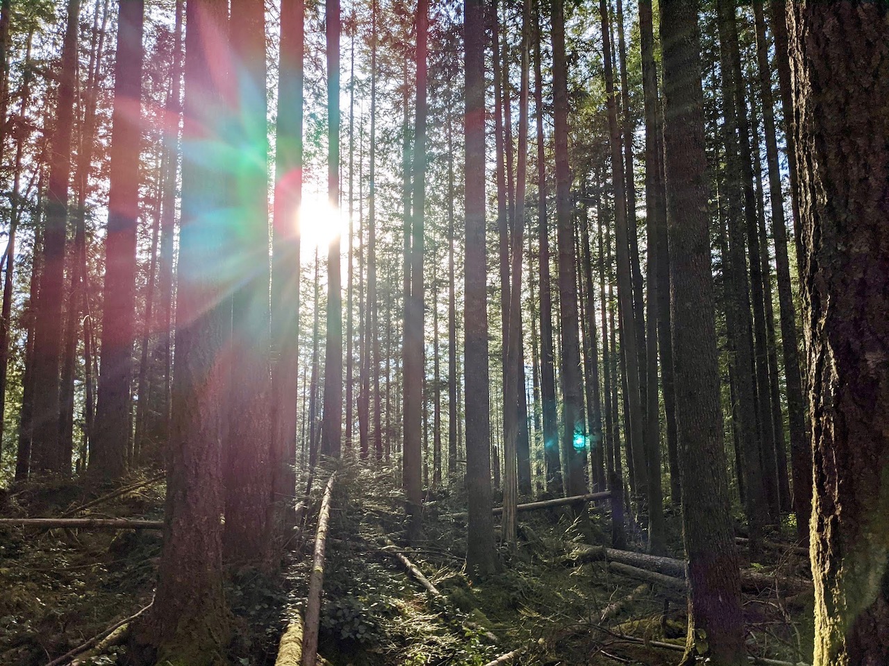
When I stepped off the train in Lauterbrunnen mid-morning, the place was buzzing. Newly arrived tourists wheeled their bags up the sloping hill through town, eyes craning to catch sight of Staubbach Falls just beyond the string of Alpine hotels. I kept my eyes on the waterfall, too, passing the many gawkers who stood starstruck by the sheer cliffs of the Lauterbrunnen Valley.

When the main road through Lauterbrunnen curved downhill to the left, I continued straight ahead, passing the Horner Pub on my right. Soon, the full height of Staubbach Falls came into view. Starting from the small picnic area near the waterfall, a narrow trail winds its way up to the base of the falls. It’s a short but steep detour from the main Lauterbrunnen Valley walk, and gives you the chance to step behind the towering cascade, its spray filling the air. On this trip, I gave it a pass, but I recommend stopping by if this is your first visit to Lauterbrunnen.

I left Staubbach Falls behind, eager to leave the road and continue my hike on the (mostly) car-free paved trail. While pedestrians far outnumber cars here, the first part of this walk is still an active road as you head out of town. Once past the outskirts, you may encounter the rare car on certain sections, as locals use it to access the farmhouses that dot the Lauterbrunnen Valley. Fortunately, these encounters are few and far between, leaving you to enjoy a peaceful walk through the awe-inspiring valley.

About midway through the valley, one of the yellow trail signs points the way toward Trümmelbach Falls. This is another sight I highly recommend. Head left from the valley trail to follow the path to the Trümmelbach Falls entrance. Once you’ve purchased your ticket, an elevator whisks you up into the rock canyon carved into the mountainside by this magnificent waterfall. Photos don’t do it justice; To fully experience the sheer power of Trümmelbach, you have to witness it in person as it roars its way down a series of ten cascades through the cavern. It’s also a great rainy day activity. Prepare to get wet regardless of the weather!

Back on the Lauterbrunnen Valley Trail, there are some more fun stops along the way. Take this place, for example. It’s a self-service vending machine for Alpine cheese and farm fresh eggs. Yum!

As the trail continues through the valley, you’ll be treated to more waterfall and mountain sightings in the distance. Eventually, the path veers in the forest, following a bubbling creek. On the right, a picnic area offers the perfect place to sit and rest within view of graceful Mürrenbach Falls. There’s even wood to make your own fire if you’re so inclined. Just ahead on the left, a bridge leads over the river to the Schilthornbahn cable car station in the tiny hamlet of Stechelberg.

For many, this will be a good stopping point. From here, you can take the cable car to the tiny village of Gimmelwald, perched on the cliff above. You can then continue by cable car all the way to the top of the Schilhorn mountain, where a 360-degree view of the Alps awaits. It’s also possible to walk from Gimmelwald to the town of Mürren, which I discuss in detail below.
But if you are up for a little adventure and a stiff climb, read on. The trail from Stechelberg to Gimmelwald offers some surprises all it’s own…
My Experience: Stechelberg to Gimmelwald
From the Schilthorn cable car station in Stechelberg, I continued my walk along the trail deeper into the Lauterbrunnen Valley. As I neared the end of the valley, a trail sign pointed the way to Gimmelwald. I kept to the right, then left the wide valley trail behind for a narrow track leading up the hill.

In case you were wondering, there isn’t much of note in Stechelberg beyond the cable car station — a few mountain chalets, pensions, barns, and a campground make up most of the village. It is, however, the starting point for many excellent hikes that lead deep into the wilds of the Sefinen Valley. But I’ll save those wonders for another time. Today, Gimmelwald was the goal.

The trail from Stechelberg to Gimmelwald starts off easy with a graceful bridge arching over a pipeline across the Lütschine River. Just ahead, Stechelberg Falls rushes down a narrow gorge. These views come almost effortlessly, but don’t be fooled. If you hope to spot more waterfalls along this trail, you’ll have to work for it.

As I passed Stechelberg Falls, the trail began to climb. I slowed my pace to prepare for the onslaught ahead. This was not my first time hiking this route, so I knew what to expect. Pausing a moment to catch my breath, I turned to take in the view behind me. Across the valley, Staldenbach Falls tumbled down the cliffs toward Stechelberg. It was an awe-inspiring sight, and only a taste of what was to come.

The trail continued its steady ascent. It’s well-maintained, but the switchbacks are neverending. Thankfully, stair steps built into the trail help ease the journey. Some may prefer to hike down from Gimmelwald rather than up. That’s not a bad approach, but be prepared for sore knees by the end.

I spotted a couple ahead of me on the trail. Their pace was similar to mine, but I soon noticed one key difference between us. One member of the couple carried a toddler in a hiking carrier on his back. Whew! My own backpack, which contained little more than a water bottle, rain jacket, and a few snacks, felt puny by comparison.

Eventually, after many, many switchbacks, I came to a sign indicating that Gimmelwald was now just 50 minutes away. OK, Gimmelwald: challenge accepted! The sign also pointed toward another trail branching off to Obersteinberg, a picturesque mountain hut in the heart of the Sefinen Valley. I kept to the right, steadfast in my mission to reach Gimmelwald (now within 50 minutes), passing two beautiful waterfalls, one on each side of the trail.

Soon, yet another waterfall came into view. I was now high above the Lauterbrunnen Valley floor, and feeling pretty good about my progress. A newly constructed wooden bridge passed by one of the waterfalls, and I relished the break from the constant switchbacks.

Of course, that break was not to last. After a brief downhill jaunt, the trail split once again. The sign for Gimmelwald pointed to a narrow gravel path leading up the steep hillside. Yes, up. I took a slow, steady pace up the hill, still determined to make it into town within 50 minutes.

So often, it’s the final stretch that really tests you. Carefully, I strode up the trail, mindful that with each step I drew closer to my goal. Finally, I caught sight of Mountain Hostel: I had made it to Gimmelwald! And I managed to do it in just under 45 minutes after passing the 50-minute marker, thank you very much.

Ready to ease my feet and slake my thirst, I plopped down at a picnic table at the hostel and ordered a pizza and beer, all while marveling at the incredible mountain views. It was a well-deserved reward, and I savored every moment.
My Experience: Gimmelwald to Mürren
Whether you reached Gimmelwald by cable car or on foot, take some time to explore a little before you move on. True, there isn’t much in this small Alpine village, but that’s part of its charm. The Mountain Hostel, Pension Gimmelwald, and the Honesty Shop, all clustered together near the cable car station, are its touristic epicenter. I enjoyed a leisurely lunch at the hostel, but the pension is also a great choice. It’s also the place to try Gimmelwald’s own locally brewed beer, Schwartz Mönch, named for the mountain across the valley that dominates the view here.

Now, before you go any further, take note: it’s a lot easier to hike from Mürren to Gimmelwald rather than Gimmelwld to Mürren. It’s an easy, wide paved path in either direction, but since Mürren lies uphill from Gimmelwald, starting in Gimmelwald requires more time and effort. With that in mind, this is a good walk to do on a return trip from the Schilthorn, as you can disembark from the cable car in Mürren and make your way to Gimmelwald on foot. It’s also a nice option if you are approaching Mürren by taking the train or hiking from Grütschalp.

In my case, since I was already in Gimmelwald, I had no choice but to once again head uphill. Dark clouds rolled in as I slowly climbed the wide, paved path. Perhaps a little rain was in store? Ahead of me, the cable car to Mürren passed over the road. I guess some people prefer the easy way!

Sure enough, it wasn’t long before it began to rain. A few large drops landed on my shoulders, followed by a few more in quick succession. I pulled my rain jacket out, thankful to be prepared. Weather is unpredictable in the mountains, and even the clearest morning may see afternoon thunderstorms.

The rain fell fast and heavy as I walked the switchbacks up to Mürren. The path between the villages is also used as a road for small tractors and other vehicles that service the local farms and businesses. While there is little traffic thanks to the high Alpine location, you may see an occasional tractor or delivery car trundle by.

The rain started to abate as I approached Mürren. A crossroads at the edge of town pointed in two different directions, one toward the cable car station and one toward the train station. If you wish to ascend to the top of the Schilthorn for its famous 360-degree views and revolving restaurant (and little 007 James Bond kitsch), head for the cable car. In my case, I turned toward the train station and continued my hike.

As I walked through Mürren, the skies cleared and I caught glimpses of the mountains across the Lauterbrunnen Valley. Due to the recent rain, the restaurant terraces stood empty, but I had no doubt patrons would soon arrive now that the sun was out again. Mürren is a great place to enjoy a meal or drink with a view.
For an even better view, a world-class children’s playground, and a terrific mountain restaurant, head up the hill to catch the funicular from Mürren to Almendhubel. It’s possible to hike to this stunning location as well, which also features a charming wildflower garden.

But for now, it was time for me to continue on my own hike from Mürren to Winteregg. I passed the train station on my way out of town, already anticipating even more glorious mountain views to come…
My Experience: Mürren to Winteregg
The gravel path from Mürren to Grütschalp is wide and nearly flat. The initial stretch follows closely along the train tracks. There are some outstanding views along this easier hike, but if you prefer something that takes you further from the train tracks and higher into the mountains, there are other trails that connect both Mürren and Almendhubel with Grütschalp. This loop hike featured on AllTrails includes one such alternative route.

In my case, I needed something easy and flat. I’d already done a few miles of uphill hiking, and soon I’d be descending back to Lauterbrunnen on an even steeper trail. For now, it was time to relax and enjoy the scenery. And also the occasional train chugging by. But in the Swiss Alps, a chugging train sometimes just adds to the ambiance, don’t you think?

Further along, the trail drew further from the train tracks along a gentle uphill slope. In some areas, evergreen trees block the view of the mountains to the east, but the trees frequently part to reveal the Jungfrau, Mönch, and Eiger in all their glory. Few hikes offer such glorious views for so little effort.

As I approached Winteregg, the trail wound lazily down the hill to meet the train station and restaurant. To clarify, the name Winteregg has nothing to do with consuming breakfast foods during the colder months. In this case, “egg” refers to a flat place jutting out from the mountains (so I’m given to understand). Winteregg is a popular spot for skiing in winter, so the name feels fitting. In summer, the restaurant offers a grand view terrace and children’s playground.

Once you reach Winteregg, the best option for most is to continue the gentle downhill hike to Grütschalp. From there, it’s an easy cable car ride back to Lauterbrunnen. But you know me… why take the easy way down? Although I have hiked from Grütschalp to Lauterbrunnen on past trips, I had never hiked down from Winteregg. And if you thought the trek up to Gimmelwald was intense, well, hang on to your hiking poles… you ain’t seen nothin’ yet!
My Experience: Winteregg to Lauterbrunnen
My hike from Winteregg to Lauterbrunnen started off easily enough. From the restaurant at Winteregg, I headed a short distance down the paved road. Soon, a signpost indicated a trail to my right, and I noticed a rough trail branching off from the road. This, it turns out, was only a small sign of what was to come.

I took the trail to the right, which led steeply through the forest before crossing a few open pastures. At times, the trail almost disappeared, but only for a few feet. It was always easy to look ahead and see the path continuing through the grass. Briefly, it joined back up with the paved road before branching off again.
Hikers, take note: if you prefer an easier route to Lauterbrunnen, follow the paved road instead of the trail. This is officially the bike route, but you can hike it as well. It will still be steep, but not nearly as rough as the hike I’m about to undertake.

On this first section of the trail, there are indeed some gorgeous views. Take a breather for a good look. Otherwise, you may find that your eyes never stray far from your feet as you navigate the slippery path (this is especially true after a rainstorm). And yes, these view are incredible, but you know what? The views are equally amazing in Mürren, or on the trail to Grütschalp. In other words, you don’t have to suffer to earn this view. That’s right, you can enjoy just such glorious views without ever having to set foot on this trail! But if you prefer to suffer a bit, read on…

My pace slowed significantly as I worked my way down the trail, carefully maneuvering to avoid a fall. I didn’t have trekking poles, but highly recommend them if you choose to do this hike. Eventually, I encountered another signpost that again pointed to the right to continue the trek. Other paths may also lead to Lauterbrunnen, but via a longer route. My goal was to follow the most direct route possible.

Once again, the trail continued steeply down the hill and the views were now fewer and further between. When I began this hike, the signpost indicated that Lauterbrunnen was only one hour and 45 minutes away, but I could already tell there was no way I would make that time. Maybe my legs were too tired from the hiking I’d already done, or maybe the recent rain made the trail too slick, but my pace was definitely slower. All the better to avoid a nasty fall, I figured.

Further along, a small picnic area provided a brief respite from the steep trail. A rustic hiker’s hut provided shelter from potential rainstorms. There is another trail junction at this point, leading either toward Mürren or Lauterbrunnen. I turned toward Lauterbrunnen, continuing my slow descent.

There were a few reprieves from the steep downward slope, but not many. I admired a couple of new bridges crossing the mountain streams, evidence of recent trail work. I can only imagine how difficult it must have been to carry the supplies up the trail! At one stream crossing, a sign indicated I was passing over Staubbach Creek. Not far from this spot, Staubbach Falls dropped dramatically over the cliff toward Lauterbrunnen. I was standing more or less directly over the point where my hike began, even though I couldn’t see the waterfall from this spot.

I continued on, my eyes cast downward as I carefully placed each step to avoid a fall. There are some benefits to looking down, I noted, as I spied a few dark-skinned Alpine salamanders scampering along the trail.

By this time, my knees were beginning to shake. The trail was rocky here, but thankfully nothing I couldn’t handle. Still, it was a blessed relief when the town of Lauterbrunnen came into view.

On the final approach into town, the views opened up again. By this time, my sole focus was on reaching the train station, where I relished the chance to collapse onto a bench and await the return train to Wengen. What a relief to glide effortlessly uphill from my very own seat on a cogwheel train! Heaven, indeed.
But despite the hardship (and truly, I knew what I was getting into), I’m glad to have hiked this final trail. Completing a full circle around the Lauterbrunnen Valley on foot provided me with an immense sense of satisfaction. It also gave me the chance to relay this experience to you, and I have the feeling there are other crazy hikers out there eager to try this trail. And if you’re not one of those, well, that’s why the cable car is there. I highly recommend it.
Whichever trails you choose to hike, the Lauterbrunnen Valley is sure to delight and surprise you. I hope this insight helps you plan the perfect visit, one tailored to fulfill your own unique Swiss Alpine dreams.


