Looking for more to explore in the Columbia River Gorge?
Visit my Columbia River Gorge Hiking Guide for more amazing trails. For the best food and drink, check out my guide to Eating Up the Columbia River Gorge.
LOCATION
The Mosier Plateau is located in the tiny town of Mosier, Oregon, about 7.5 miles east of Hood River on Highway 30.
LENGTH
2.5 miles out and back to the viewpoint atop Mosier Plateau; less than one mile to and from the waterfall. You can go further along the plateau to capture more views for a 3.5-mile round trip hike.
DIFFICULTY
Moderate — The hike to the plateau includes a steep climb up a series of switchbacks. Fortunately, it’s not long, and you can take it slow. Those looking for a short walk with less of an uphill climb can walk to the cemetery and waterfall. There’s a very short uphill section at the start of the trail, but after that it’s fairly level to the falls.
WE HIKED IT
April, 2021, about two hours
CURRENT INFO
The Mosier Plateau trail is managed jointly by the Friends of the Columbia Gorge and the city of Mosier. Check the Freinds of the Columbia Gorge website for good trail information. Trail reports are available on the WTA (Washington Trails Association) website.
GOOD TO KNOW
- Free parking and a public restroom are available near Totem Pole Plaza, about 1000 feet west of the Mosier Plateau trailhead.
- The trail literally begins along Highway 30, just east of Mosier Creek Bridge.
- There are no toilets or other facilities at the trailhead, but there is a sign with a trail map near the start of the trail.
- Several benches are available along the trail, including two near the start.
- Pets on leash are permitted.
- Please stay on the trail and do not pick the flowers.
- In summer, the pool above the waterfall becomes a local swimming hole. Please use caution, and don’t swim here unless the water level is low enough and the creek is calm. It’s best for older, experienced swimmers. More information is included in the book Swimming Holes of Washington by Shane Robinson and Anna Katz.

- Keep an eye out for poison oak! Stay on the trail and don’t touch or brush up against any unknown plants to avoid coming down with an itchy rash! Poison oak leaves range from red to green, as shown in the photo above. They lose their leaves in winter, but brushing up against the bare branches can still cause a rash, so play it safe and keep to the trail.
HIGHLIGHTS
The view from Mosier Plateau is magnificent, and golden balsamroot flowers are a highlight in April. But if you don’t want to hike all the way to the plateau, don’t worry — you can also find great views along the Historic Columbia River State Highway Trail or the Rowena Crest viewpoint. The Mosier Waterfall, a beautiful falls that cuts through a steep basalt ravine, is an easier destination if you prefer to do just the first part of this hike.

THE KIDS’ TAKE
The start of the hike, after the initial climb from the road, was fun and easy. Both the cemetery and waterfall drew interest from my boys. Then came the uphill climb. “My batteries are almost out of energy,” as five-year-old T put it. I thought he’d choose to stay below with his grandpa, but no — he stuck to it and hiked all the way to the top! Scandinavian Swimmer candies were a big help when the going got tough.
WHILE YOU’RE HERE
Since the hike to Mosier Plateau is short, why not try some other fun local activities? We loved biking the Historic Columbia River Highway State Trail from Hood River to Mosier, a dedicated non-motorized bike and walking trail with magnificent views along the river. There are picnic tables at the parking lot at the Mark O. Hatfield East trailhead in Mosier, making it an ideal spot for a lunch break. For lunch in town, Mosier Company, a family-friendly pub, provides good food and beer.
Further west near Cascade Locks, another section of the historic highway trail connects Wyeth to Viento, and includes numerous waterfalls.
For another short hike with a fabulous view, check out Rowena Plateau, located about 10 minutes east of Mosier on Highway 30. Across the Columbia River near White Salmon, Catherine Creek is alive with Camas lilies in the spring and views toward Mount Hood.
For even more great hikes, check out my Columbia River Gorge Hiking Guide. Getting hungry? Eating Up the Columbia Gorge has you covered.
Our Experience
After biking the Historic Columbia River Highway trail from Hood River to Mosier, we headed into town for a hike. Yes, you read right — we headed into town. The trailhead for the Mosier Plateau hike begins right off Highway 30 in the middle of the small town of Mosier. On one side of the trail, houses flank the hillside. My family was a little confused.
“Where is the trailhead?”
“This is the trailhead.”
“Where is the trailhead?”
“Here! This is the trailhead!”

After everyone understood that we were, in fact, at the trailhead, we headed a short distance up the steep path, bringing the cooler with us for a picnic. I quickly realized that the start of the Mosier Plateau trail is not the ideal place for a leisurely lunch, especially in coronavirus times. There are no places to set up a picnic blanket (you are expected to stay on the trail), so we squeezed onto a bench for a quick repast, then lugged the cooler back down to the car before beginning our hike.
The trail begins just past the Mosier Creek Bridge. Not far from the road, a trail map assures you that, yes, you are in the right place. Look back as you begin the hike, and you’ll be treated to a view of the lovely bridge spanning Mosier Creek with the Columbia River beyond.

The trail soon meets the Mosier pioneer cemetery, a small plot including gravestones from well over 100 years ago. Once particularly poignant marker noted the passing of seven-year-old Mildred in 1901. The name of “Mosier” could also be found, marking where members of the founding family of this pioneer settlement were buried.

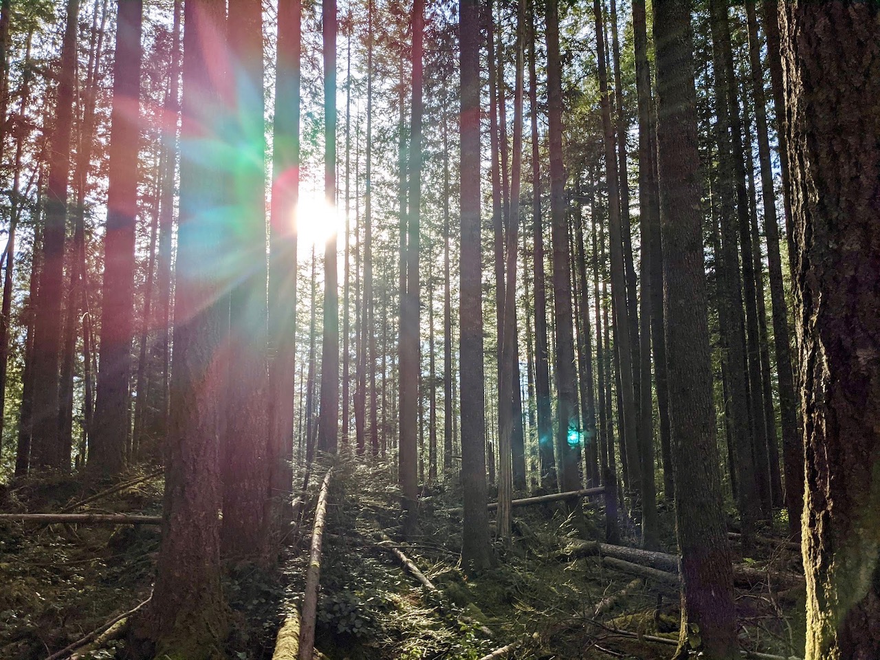
Rounding the bend, the noise of the Highway 84 disappeared under the roar of rushing water. It’s common to hear a waterfall before you see it, and Mosier Falls was no exception. Ahead of us, Mosier Creek tumbled deep into a narrow chasm carved over centuries through volcanic basalt pillars. At 70 feet, the main tier of Mosier Falls pales in comparison to some of the region’s more famous falls, but is a powerful sight nonetheless. Go in spring to see it at its peak, or in summer for a chance to swim in the small pool above the lower falls.

Not far beyond the waterfall, the trail changes from mostly level to decidedly steep. Even before starting up the switchbacks, five-year-old T was ready to throw in the towel.
“My energy is almost at zero,” he told me. “I only have this much batteries left,” he explained, holding up his hand with his fingers and thumb squeezed together. Luckily for him, his older brother came to the rescue.
“I’ll carry you,” he proclaimed, eager to show off his strength. Fine by me — I wasn’t about to hike with a five-year-old on my back!

T’s piggyback ride was short-lived, however, as J could only carry him so far. As the trail steepened, my father-in-law decided to turn back rather than climb to the plateau, and offered that T could stay with him. T, however, had no intention of staying behind. He was determined to continue, no matter how low his batteries were. Some Scandinavian Swimmers (a candy from Trader Joe’s, similar to Swedish fish), he assured me, would recharge his batteries as needed.

By this time, Michael and my parents were well ahead of us. As we climbed the switchbacks and stairs, we waved to them from below. In actuality, the trail, while steep, is not long. It may seem daunting, but the total elevation gain for the hike is only 540 feet. Keep a slow, steady pace and take a break or two, and you will be rewarded with fine views and a well-earned sense of accomplishment.

You may also want to find a shady spot under a tree and take a well deserved break. Sometimes, the view can wait.

Of course, this is a view not to be missed, especially when surrounded by swaths of sunny yellow balsamroot waving gently in the light breeze. The day was exceptionally calm, and the Columbia River serenely reflected the intense blue of the sky.

On the way down, everyone marveled at how little time it took before we were back at the waterfall. From there, it was a quick jaunt to the trailhead. I asked my mom if the climb to the top had been worth it.
“The hike to the waterfall is worth it,” she replied. “But for my age… you can find similar views elsewhere.”
True. Good views abound along the Columbia River Gorge, and you don’t need to hike to reach many of them. Still, I didn’t regret the climb. In fact, I rather enjoyed it, and recommend it for anyone who is up for a little elevation gain. I find I savor a good view even more when I have to work to reach it. But whether you’re chasing another Columbia Gorge waterfall or want to exert a little more effort to reach those views, the Mosier Plateau trail delivers.


