Looking for more places to bike along the Historic Columbia River Highway State Trail?
Check out my review on biking from Wyeth to Viento, or head further east to bike the Riverfront Trail in The Dalles.
LOCATION
The Twin Tunnels segment of the Historic Columbia River Trail begins a few miles east of Hood River, Oregon, at the end of Old Columbia River Drive. It ends a mile west of Mosier along Rock Creek Road.
LENGTH
4.5 miles one way
DIFFICULTY
Easy/moderate — The Historic Columbia River Gorge Trail is paved and well-maintained. When starting form Hood River, there are several gradual uphill sections before reaching the final descent into Mosier. The Mosier trailhead is at a lower elevation than the Hood River trailhead, so there’s more total elevation gain if you start in Mosier.
WE BIKED IT
April, 2021, about an hour one way, with a few stops to enjoy the view
CURRENT INFO
The Historic Columbia River Highway State Trail currently includes three separate sections of completed non-motorized trails that follow the path of historic Highway 30, once called the “King of Roads”. The Twin Tunnels segment, which travels from Hood River to Mosier, is the easternmost section. Find more information, including a map of the entire trail system, on the Oregon State Parks website. Further information and reviews are available on the Traillink website and walking reviews are posted on the WTA (Washington Trails Association) website. The Friends of the Columbia Gorge website also provides excellent information.
GOOD TO KNOW
- Restrooms are available at both the Hood River and Mosier trailheads.
- There is a day use fee of $5 per vehicle when parking at either trailhead.
- In Hood River, the trail begins at the Mark O. Hatfield West trailhead at the end of Old Columbia River Drive.
- In Mosier, the parking lot for the Mark O. Hatfield East Trailhead is located a short distance up the road from the actual start of the trail off of Rock Creek Road. A small number of disabled parking spaces are available at the trailhead itself.
- The Mark O. Hatfield West trailhead has a kiosk showcasing the history of the Historic Columbia River Highway and how the Mosier Twin Tunnels were built.
- The trail isn’t limited to bikers — hikers are also welcome (dogs on leash, too). The wide path is ideal for a multi-use trail and easily accommodates both bikers and pedestrians.
- Experienced bikers who want more of a challenge can continue biking on the winding roads that connect the trail with either Hood River or Mosier. These roads steep roads, and there isn’t a bike lane. For this reason I recommend them only for teens or adults who are in good shape and have experience with road biking, not young children. Fortunately, car traffic on these roads is usually light.

HIGHLIGHTS
This entire section of the Historic Columbia River Highway Trail is stunning, traveling between shady forest and wide open views across the Columbia River. During our mid-April visit, yellow balsamroot was in bloom and dotted the meadows at one of the viewpoints. Unlike the Historic Columbia River Highway Trail segment between Wyeth and Viento, the Hood River to Mosier segment stays high above Highway 84, so traffic noise is almost nonexistent.
THE KIDS’ TAKE
This is a great bike path for kids — smooth riding, fun tunnels, and no cars! Our nine-year-old rode an eight-gear bike, while my husband towed our five-year-old on the trailer bike. Once we started, they were off like a shot! Since I’m the slow mom who stops at all the viewpoints to take photos, I didn’t see them again until the end of the trail.
WHILE YOU’RE HERE
Both Hood River and Mosier are well worth an extended visit. For a hike post-bike hike, head into Mosier and follow the trail to the Mosier Plateau, which features a waterfall and incredible views. Mosier Company, a local family-friendly pub, offers tasty food and drink.
Back in Hood River, Mike’s Ice Cream is the place to go for a sweet treat. Looking for more biking or a pleasant stroll? The Hood River Waterfront Trail (or Shoreline Path) is a terrific urban multi-use trail along the Columbia River. While there, pFriem Family Brewers is a good stop for food and beer.
For more biking, head east to explore the Mitchell Point segment of the Historic Columbia River Highway Trail between Wyeth and Viento. Or head east, where the Riverfront Trail in the Dalles showcases the dry side of the Gorge. For more excellent suggestions for hikes, food, and drink, check out my Columbia River Gorge Hiking Guide and Eating Up the Columbia River Gorge: The Best Restaurants and More.
Our Experience
It was a clear, sunny, and — perhaps most significantly — wind-free morning when we arrived at the Mark O. Hatfield West Trailhead. The trailhead itself was beautiful, with a view of the Columbia River that hinted at what was to come. I paid the $5 day use fee as we prepared our bikes for the trip.
My older son, J, was, as usual, eager to be on the move and looped around the parking lot while I conferred with my mom. She wasn’t biking, so had the job of driving to the east trailhead in Mosier to meet us. Since this segment of the Historic Columbia River Highway Trail is only 4.5 miles, biking both ways is pretty reasonable. But since we planned to hike to Mosier Plateau following the bike ride, a one-way trip was best.

Once ready, Michael and the boys sped quickly out of sight with my father close behind. My father-in-law and I came last, but that was OK by me. I was in no hurry to rush through such a beautiful stretch of trail.

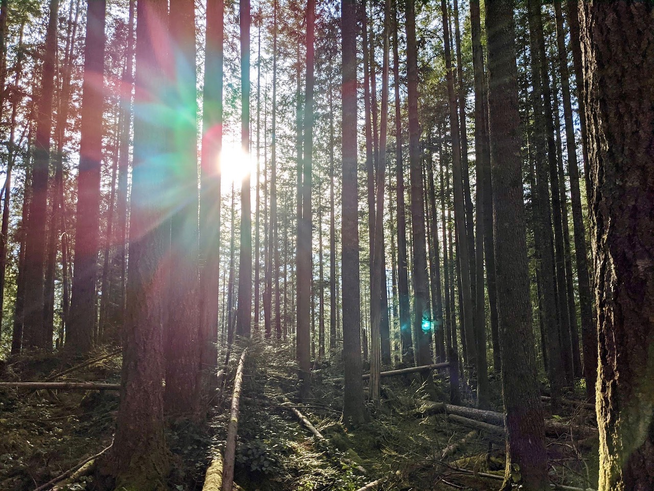
At first, the scenery was similar to what you find around Hood River, with evergreens and maples growing thickly along the trail. Sunbeams filtered through the spring green leaves as we biked. We had yet to see any other bikers or walkers on the trail, and enjoyed the quiet ride. On a weekday morning, it seems we had the place to ourselves.

Before long, we emerged from the forest atop a steep cliff, revealing views of the Columbia River far below. Above and below us, craggy rock formations stood silhouetted against the blue sky. A graceful low rock wall lined the path, tying it to its past life as the “King of Roads”, luring motorists from Portland to The Dalles.
By this point, we were traveling gradually but steadily uphill. My father-in-law stopped to enjoy the view and occasionally walk his bike. We were far behind the rest, and I was unsurprised to see my dad coming from the opposite direction to find us. All was OK — we were just taking our time. Dad informed us that the uphill stretch was nearly done, and soon we’d reach the tunnels.

The twin tunnels are the most distinctive feature along this section of the Historic Columbia River Trail. Part of the original Highway 30, the tunnels were closed and filled in with rock after Highway I-84 opened in 1954. In 2000, the tunnels were finally reopened when this segment of the new Historic Columbia River Highway State Trail was realized. Today, it’s a treat to ride through this piece of Oregon’s history.

Popping out on the Mosier side of the tunnels, a new landscape greeted us. Sunny balsamroot blooms spread across open meadows and scattered oak trees replaced the dense forest. We detoured to a gorgeous overlook looking east over the river toward Mosier and The Dalles.

The last part of the ride was an easy glide down the gently winding trail. A couple of small lakes just outside Mosier appeared below the cliffs, and I had to stop yet again to appreciate the changing views. Here on the eastern side of the Columbia Gorge the climate is significantly more arid, but no less stunning. We passed a few people out for a walk or ride, but still found ourselves enjoying the grandeur around us in near solitude.

On my arrival at the trailhead, I found the rest of my family looking confused. “Where’s grandma?” they asked. No cars were parked in the small lot near the end of the trail.
“That’s disabled parking,” I explained. “We have to head up the road to the main parking lot.” We turned right alongside the road and headed uphill. A short section of paved trail and a wide shoulder eased the way, but we still had to cross the road to reach the parking lot. Fortunately, traffic here is light.

There at the parking lot, my mom awaited our return. My dad and I drove back to the Hood River trailhead to retrieve the second car while the rest of the family stayed to enjoy a snack at a shaded picnic table. It had been a glorious ride — I only wish it could have been longer! Of course, you can always double your fun by biking out and back rather than one way. And hopefully in the future, the individual bike trails along the Columbia River will finally be connected in one seamless, car-free route. For now, don’t miss an opportunity to enjoy some of the best views and easy biking that the Columbia River Gorge has to offer!


