Looking for more great hikes on the eastern side of Mount Rainier?
Try the Naches Peak Loop for incredible mountain views!
CURRENT INFO
Find good information on the Washington Trails Association (WTA) website, including clear driving directions to the trailhead.
LOCATION
Mount Rainier
LENGTH
4 miles out and back (more if you continue past Stafford Falls, intentionally or not…)
DIFFICULTY
Easy/Moderate — Overall, Stafford Falls is a level, easy hike. Most of the elevation change comes at the start, when you’ll quickly descend to meet up with the creek. Of course, this means you need to be prepared to climb back up on the return. Also, if you want to get to the base of the falls, be prepared to maneuver over fallen logs and boulders on a somewhat steep slope.
WE HIKED IT
July, 2020, about 4 hours, including a picnic stop at Stafford Falls (and also accidentally hiking at least a quarter mile past the turnoff to the falls before backtracking)
GOOD TO KNOW
Although the trail to Stafford Falls lies within Mount Rainier National Park, the trailhead is located just outside the park boundary. No passes are required. There is limited parking along the side of the road, so arriving in the morning is recommended, although this trail is surprisingly less busy than you might expect. There are no restrooms or vault toilets. National park rules apply, so dogs are not allowed.
HIGHLIGHTS
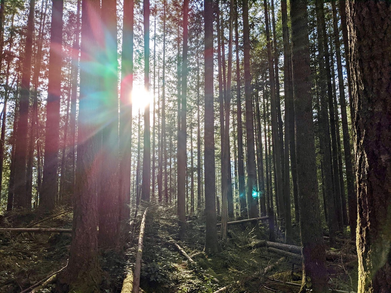
The hike to Stafford Falls includes multiple waterfalls and sparkling clear streams, all along a peaceful forest trail far from the crowds.
THE KIDS’ TAKE
The shallow creek near Stafford Falls is perfect for a play break. Bridges by the other falls en route are also pretty cool.
WHILE YOU’RE HERE
It’s Mount Rainier, so there are plenty of opportunities to explore further. This is a great option to include as part of a longer visit to the park, as it doesn’t get the crowds you’ll typically find at Paradise and Sunrise. And because it’s located midway between those two prime hiking hubs, efficient hikers can easily pair it with an additional short hike. Check out the Naches Peak Loop for a popular option that includes stunning view of Mount Rainier.
If you’re looking for one longer hike, continue on this same trail past Stafford Falls to Owyhigh Lakes, upping the hike from four miles to ten. For more information on this option, see the WTA website posting.
Our Experience
While I tend to enjoy a trail less traveled in any season, with the Coronavirous epidemic still going strong this summer, I’ve been challenged to find hikes that provide stunning scenery without stifling crowds. I’ve spent hours combing hike reviews on the WTA (Washington Trails Association) website trying to find just the right hike for our family. One not too long, but long enough, not too close to home, but not too far, and, of course, one without too many other hikers, giving us the space to enjoy it without feeling like we could be putting others (or ourselves) at risk.
Then, I stumbled across the description for Stafford Falls, a destination I’d never heard of, and it sounded, well, perfect. Four miles round trip, minimal elevation gain, and about a two hour drive from home (my typical limit for a day hike).
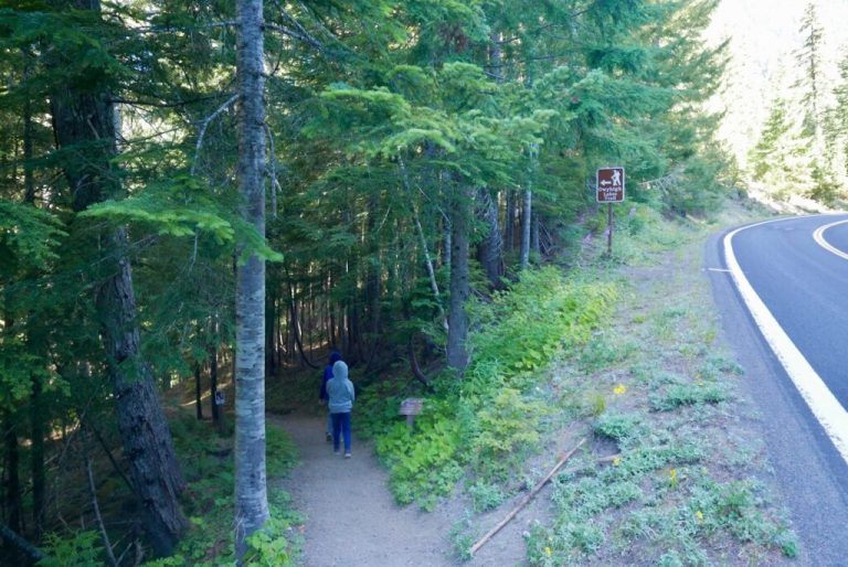
We arrived mid-morning, thankful to find one easy parking spot still open at the side of the road. A small roadside sign stating “Owyhigh Lakes Trail” is the only indication that you are at the right place. Downhill we went, passing our first waterfall in mere minutes, as Deer Creek tumbled down a rocky pitch alongside the trail.

Not long after, we came to a second waterfall, this time a short detour off the Stafford Falls trail. To reach it, once the trail stops descending, take a right onto the Eastside trail. Cross two bridges in short succession, and you’ll find a lovely little falls on Chinook Creek.

Back on the main trail, the path weaves gently through the forest. After another mile or so, we came to a scenic gorge, sunlight streaming down on the clear water as it bounded through the rocks. After taking a few minutes on the bridge to soak in the view, we headed on, eager for a picnic lunch at Stafford Falls.
After awhile, the path became rockier and a bit steeper. My friend also noticed that her phone indicated we had traveled more than two miles, yet hadn’t seen the turnoff to the falls. I was doubtful. Could we really have missed it? Without cell coverage, we scanned the hike description that one of us had thoughtfully saved to his phone, trying to determine where we might have gone wrong. Two of us were sent on a mission to investigate further down the trail, while the rest of us waited, perhaps a little impatiently.
Sure enough, there was no sign of a waterfall further down the trail, so we turned around to head back. Soon, another couple passed us headed in the opposite direction. “Did you see Stafford Falls?” we asked. “Yes, it’s beautiful!” they responded. “The trail is just ahead.” Well, that settled it. We had missed it. But at least now we knew we were headed the right way.

We made our way back up one of the steeper sections of the trail. Please note: if you start heading down a path that looks strikingly similar to the one pictured above, you have gone too far. We also passed over a small wooden footbridge. Second note: If you pass over a small wooden footbridge after you cross the main river by the gorge, you have gone too far.
Fortunately, this time we had no problem spotting the trail. How could we have missed it? Well, it isn’t signed for one thing, and the path is less defined than the main trail, allowing it to easily hide in plain sight from those who are not paying attention (guilty as charged). In fact, when we first passed this spot, we had paused mere feet from this point, trying to ascertain if the waterfall might be below us, and I had dismissed it as merely the river flowing loudly over some boulders. Live and learn!

The side trail leads to a view of a pretty punchbowl falls pouring into a large pool of aquamarine water. What Stafford Falls lacks in size it makes up for in sheer beauty. From the viewpoint, a sort of deer trail winds haphazardly down to the creek below, where a rocky shore perfect for picnicking awaits. Getting down can be a bit tricky due to some fallen logs, but our group made it without difficulty.

After enjoying lunch by the crystal clear water and giving the kids a chance to play, we headed back to the trailhead. While we had seen only a couple of others on the hike out, on the way back we passed several other parties. Most wore masks and everyone stepped politely to the side when passing.
Back at the trailhead, I marveled at how such a beautiful, simple day hike had remained relatively hidden while so many others have been mobbed in recent months as urbanites flock to the outdoors for respite during the pandemic. Perhaps because the two hour drive from Seattle makes it less accessible to some? Or because, despite the fact it lies within Mount Rainier National Park, it offers no mountain views? Or because of the small, practically unmarked trailhead? I can’t know for certain, but I do know that I am grateful for having found it, and for the opportunity to share the experience with family and friends.


