Head to the Foothills in the south end of Sequoia National Park to swim in the crystal clear Middle Fork Kaweah River, discover ancient pictographs, and experience a different side to the Sierras.
Looking for more fun things to do in Sequoia National Park?
Check out my reviews on hiking to the top of Moro Rock and hiking Crescent and Log Meadows.
LOCATION
- The Foothills region lies at the southern end of Sequoia National Park along the Generals Highway. The Generals Highway is the only road that travels all the way through Sequoia National Park, connecting with Highway 198 at the south end and Highway 180 at the north end. Three Rivers, just southwest of the Foothills park entrance, is the closest town to this area of the park.
CURRENT INFO
- For an introduction to Foothills in Sequoia National Park, check out the National Park Service website. There are some great trails in this region, and they typically see far less foot traffic than the popular trails around Lodgepole and Giant Forest. We didn’t have time to hike during our visit, but check out the book Hike the Parks: Sequoia-Kings Canyon National Parks by Scott Turner for detailed information about some of the area’s best day hikes.
WE WERE THERE
- June, 2021, spending an afternoon discovering pictographs, swimming, and spotting wildlife

GOOD TO KNOW
- Since Foothills lies within Sequoia National Park, you must present an America the Beautiful pass (or other national parks pass) or pay the $35 entrance fee (valid for up to seven days) when you enter the park. You can also purchase an annual pass at the park entrance. Check ahead of time to see if you qualify for a free pass — fourth graders and active military do! Fourth graders must print a voucher ahead of time to qualify.
- The Generals Highway really amps up the twists and turns as it winds through Foothills. If you get motion sickness, plan ahead and bring medication if needed. The road is well-maintained, but not recommended for trailers or large RVs. Due to weather conditions, the Generals Highway may be partially closed in winter, so check conditions ahead of time if you plan an off-season visit.
- Hospital Rock hosts a lovely, shaded picnic area with restrooms, drinking water, picnic tables, garbage bins, and bear boxes. Interpretive signs highlight the area’s flora and fauna.
- Potwisha Pictographs offers a large parking area with a vault toilet, garbage bins, and bear boxes.
- Near the southern entrance to Sequoia National Park, the Foothills Visitor Center, open from 8:30am to 4:00pm in summer, provides information, restrooms, and a gift shop. Exhibits feature the local ecology and human history of Foothills.
- Food is not available in this section of the park, so bring your own, or head to the town of Three Rivers.
- In summer, daytime temperatures in Foothills can be scorching, easily reaching the upper 90s or higher. Water, sunscreen, and shade hats are a must!

WHAT TO BRING
Planning to swim? Don’t forget your swimsuits! On our visit, I made the embarrassing mistake of leaving the key to our roof box behind at our campsite at Azalea Campground. And yes, the swimsuits were conveniently stashed in the roof box. Fortunately, it was a hot day and we were wearing quick-dry clothing. Foothills gets quite hot in the summer, and a dip in the cold, clear water of the Middle Fork Kaweah River brings welcome relief from the heat.
The path down to the river can be rocky, sandy, and steep. Wear shoes or sandals with good traction.
Also on the list: snacks, water, sunscreen, shade hats, bug spray (we didn’t have any bug issues, but you never know), towels, and any other beach or picnic supplies you may need. Garbage bins and toilets are available at parking areas. Please do your part to clean up after yourself and keep our parks clean and pristine for your fellow humans and the local wildlife.

RIVER SAFETY
Be mindful — the changing water flow throughout the year can dramatically alter how safe it is to swim in the Middle Fork Kaweah River. When we visited, the water level was low, creating calm, shallow pools that were perfect for playing in the water. Even when the river is mostly calm, some places may have strong currents, and extra care should be taken whenever swimming near waterfalls. Keep a close eye on children and be mindful of where you choose to swim.

POISON OAK
Our old pal poison oak is back! If you missed him in the Giant Forest and Lodgepole sections of Sequoia National Park, never fear — he’s alive and well in Foothills. Fortunately, it’s usually easy to avoid if you keep an eye out.
The oils produced by this noxious plant can cause severe itching and rashes if you come into contact with it. Avoid it by staying on trails, and don’t brush up against the plant life. For those unfamiliar with this infamous plant, I’ve included a photo below. You may have heard the saying, “leaves of three, let it be,” referring to the fact that poison oak leaves grow in groups of three. Please note, however, that it changes in appearance throughout the year. Leaves range in color from green to yellow to red. In winter, the leaves fall off, leaving behind bare sticks that are difficult to spot amidst the surrounding brush.

HIGHLIGHTS
Come to Foothills to see another side of Sequoia National Park, where gnarled oaks replace giant sequoias. This was an important area to the Native American tribes who made their home here. Look for mortar holes, once used for grinding acorns, pounded into the rock. Pictographs at Hospital Rock mark a sacred place that is still revered today. Nearby, the Middle Fork Kaweah River shimmers in the dappled sunlight, offering a refreshing break from the summer heat.

THE KIDS’ TAKE
Five-year-old T was initially heartbroken when I discovered I left the key to our roof box back at our campsite in Azalea. Without the key, we couldn’t reach our swimsuits or the sand toys. I assured him that on such a hot day he could just swim in his clothes, and swim he did. The kids loved the sparkling clear water of the Middle Fork Kaweah River, and could have played there happily for hours!

WHILE YOU’RE HERE
You’re in Sequoia National Park, so there is no shortage of things to do! We hiked to Moro Rock and Crescent and Log Meadows in the morning before driving to Foothills. In fact, this was the day we drove the entire length of Sequoia National Park, starting and ending at our campsite in Azalea Campground in the Grant Grove section of Kings Canyon National Park. It’s a fantastic way to see the mountain scenery of the Sierras change (and feel the temperature rise) as you wind your way down into Foothills.
There’s so much to see in this area, why not spend the night? Sequoia and Kings Canyon National Parks offer numerous campgrounds, and many more are located in the surrounding Sequoia National Forest. We loved our stay at Azalea Campground. Looking to camp in Foothills? Potwisha Campground or Buckeye Flat Campground (tents only) are beautiful, but please note that this is the hottest area of the park, so expect high temperatures in summer.
Our Experience
This guide covers a couple of key stops along the Middle Fork Kaweah River, Hospital Rock and Potwisha, that feature Native American pictographs and beautiful summer swimming holes.
Further south, check out the exhibits at the Foothills Visitor Center at the southern entrance to Sequoia National Park,
and head into the town of Three Rivers for a laid back lunch or dinner.


GENERALS HIGHWAY
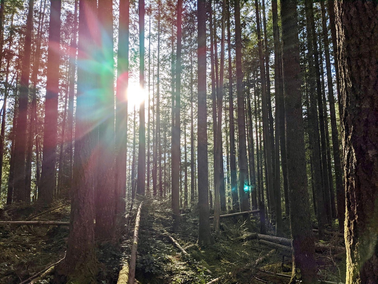
Most visitors enter Sequoia National Park from the north. Since Foothills lies in the south, the best way to reach it (and the only way, practically speaking) is via the spectacular Generals Highway. This scenic road winds it way south for 32.5 miles, going from a peak elevation of around 7000 feet near Wuksachi to a low of 1500 feet at the south park entrance in Foothills. Expect steep curves, especially between Giant Forest and Hospital Rock. While this section of the highway (pictured above) is only 10.5 miles, plan at least half an hour for the drive as you navigate hairpin curves and stop to marvel at the views.
You can also enter Foothills from the south. It’s still a winding route, but it’s more doable for trailers or RVs, or those with sensitive stomachs.
We were thrilled to encounter our second bear sighting of the day as we made our way south from Giant Forest. If you see a car stopped ahead of you, take a look around — chances are good you’ll spot some wildlife nearby. We also caught a great view of Moro Rock, which we climbed earlier the same morning.


HOSPITAL ROCK
After the tortuous drive down Generals Highway, we pulled into a shady parking spot at Hospital Rock. The picnic tables were inviting, but we’d had lunch already at Crescent Meadow, and the afternoon heat made swimming sound especially appealing. It was at that moment I realized… our swim gear was in the roof box. This was not unusual. What was unusual, or at least unfortunate, was that I did not have the key to open the roof box. That key remained at our campiste at Azalea Campground, safely locked in our teardrop trailer.
Such is life. Five-year-old T was crushed, while the rest of the family was chagrined but not defeated.
“It’s a hot day, and your clothes will dry fast,” I promised T. “If you want, you can swim in your clothes.”
He wasn’t too keen on the idea, but grudgingly followed us across the road to Hospital Rock. Before heading down to the river, we admired the ancient pictographs that decorate the underside of a granite boulder, and marveled at the deep, smooth holes worn into the bedrock. Hundreds of years earlier, women from the local tribes gathered on this very spot to grind the acorns that were a staple food source for their families.


From Hospital rock, a tree-lined dirt trail led away from the road. Soon, the path turned rocky, and we found ourselves climbing between boulders, searching for the best way down. From above, we saw a beautiful emerald pool nestled among the rocks. A short tunnel through the boulders led to a stone staircase, depositing us along the sandy shores of the shimmering pool.
A few others were there when we arrived, but we soon had the place to ourselves. Sure enough, the lack of a swimsuit was no barrier for T. He was soon splashing and sliding down low granite boulders into the cold, translucent green water. While the rest of the family played, I climbed back up the rocky trail to check out another pocket beach just upriver. Small cascading waterfalls separate the different pools as the river travels down through the Foothills. Our spot, I decided, was best for kids, with its shallow, placid water. The small pool upriver provided deeper water for stronger swimmers.
Eventually, it was time to move on. The boys were reluctant to leave our swimming spot at Hospital Rock, but I was excited to discover what else Foothills had to offer.


POTWISHA PICTOGRAPHS
We almost missed the turnoff for this gorgeous spot. Along Generals Highway, there is no sign indicating “Potwisha Pictographs” only “Dump Station”. Maybe I’m missing something, but “Dump Station” doesn’t quite have the same ring to it. Fortunately, our guidebook, Hike the Parks: Sequoia-Kings Canyon National Parks, indicated the parking area for the pictographs was located opposite the Potwisha Campground, which was clearly signed. We turned into the dump station, and drove past it to discover a large gravel parking area near the river.
The kids were immediately drawn to a large tree, perfect for climbing, not far from our parking spot. I encourged them to keep going. We were on the hunt for more pictographs! Plus, there was a cool bridge just up ahead! Soon, we came to a gently sloping granite slab. The smooth, circular holes indicated that here was another mortar stone once used by the local tribes. Not far past this point, Michael pointed up toward the underside of a giant boulder above out heads. There were the pictographs, cleverly painted to avoid the worst wear and tear from the weather.
As we continued toward the bridge, we were stopped in our path by the appearance of a small group of grazing deer. The deer in Sequoia National Park have it pretty good, and know they have little to fear. Taking hardly any notice of us humans, they wandered up the hillside, continuing their grazing.
We could now see the bridge, and it was indeed a stunner. The Middle Fork Kaweah River sparkled below next to an inviting white sandy beach. What a delight! If only we had more time for a swim! In retrospect, I definitely would have planned more time along this gorgeous stretch of the river. As it was, we soaked in what we could of the beauty around us, enjoying what time we had. Please be aware — the current here can be swift, and swimming conditions are not always safe. Check the area when you arrive, choose a swimming spot wisely, and keep a close watch on children.


FOOTHILLS VISITOR CENTER & BEYOND
After our stop at Potwisha Pictographs, it wasn’t long before we reached the southern boundary for Sequoia National Park. We passed the Foothills Visitor Center, now closed for the day, as it was past 4:00. For those entering the park from the south, I recommend stopping by the Visitor Center first if you can. It’s a good way to get your bearings and check with the rangers about additional trails or sights in the area. If you’re returning north, this is the point when you may wish to turn around to head back to your campsite or other lodging.
I, however, had one more thing on our agenda — food! There are no restaurants or cafes in Foothills, but the small town of Three Rivers offers several options for hungry travelers. We chose Sierra Subs, and enjoyed delicious sandwiches on an outdoor deck facing the river. Sierra Subs often closes early, so check their hours before you plan a visit.
Now, we had only the long drive back to Azalea Campground ahead of us. Rather than drive through Sequoia National Park, we took the back roads, following Dry Creek Drive (aka J21) as it wound its way through the hilly ranchland west of the park. If you’re considering this route, please note that Dry Creek is a curvy and narrow dirt road, not suitable for trailers or large RVs.
Before turning north, we drove along the striking shoreline of Lake Kaweah. The blue water shone in sharp contrast to the golden brown hills. From here, it would be almost an hour and a half before we reached our campsite. Soft evening light bathed the hills as we drove onward, savoring the last moments of an amazing day.
I hope you’ve been inspired to explore Foothills when you visit Sequoia National Park.
Do you have any favorite places you’ve enjoyed in this unique and beautiful region? Let me know in the comments below!


