Looking for more trails near Issaquah and Bellevue?
Check out Grand Ridge and Duthie Hill for hiking and mountain biking!
LOCATION
The Red Town Trailhead in Cougar Mountain Regional Wildland Park provides the best access to Coal Creek Falls and the surrounding trails. The trailhead is located three miles south of I-90 on Lakemont Boulevard off exit 13.
LENGTH
3.5-mile loop if you follow our route — other routes that include Coal Creek Falls can be as short as 2.5 miles or much longer
DIFFICULTY
Easy/Moderate – The trail is wide and well-cared for, although we had to step over a few blowdowns due to a recent wind storm. There are some gradual uphill stretches, and the trail can be muddy.
WE HIKED IT
November, 2022, about 2 hours and 45 minutes at a leisurely pace
CURRENT INFO
General information and trail updates are available on the Cougar Mountain Regional Wildland Park website. For more trail information and reviews, visit the WTA (Washington Trails Association) website. The book Best Hikes with Kids: Western Washington by Susan Elderkin features a 2.5-mile loop hike to Coal Creek Falls. Urban Trails: Eastside by Craig Romano is another good local hiking guidebook that includes several routes within Cougar Mountain Regional Wildland Park.
GOOD TO KNOW
- Parking is free in Cougar Mountain Regional Wildland Park.
- Port-a-potties, garbage bins, and a couple of picnic tables are available at the Red Town Trailhead.
- Remember to pack the 10 Essentials.
- Bring a good trail map. You can download different routes from AllTrails. Even if you don’t follow the route exactly, the AllTrails maps show other trails within the park to help you choose your own route (like we did). The guidebooks mentioned above also include helpful maps. If you don’t have access to these options, take a photo of the map posted at the kiosk at the Red Town Trailhead.
- Pets on leash are allowed at Cougar Mountain.
- Some trails at Cougar Mountain also allow horseback riding.
- Always follow Leave No Trace principles.

HIGHLIGHTS
Cougar Mountain Regional Wildland Park provides easy access to forested trails for anyone living in the Seattle Metro area. There aren’t any show-stopping sights along the loop we took (Coal Creek Falls was barely more than a trickle), but the woods are beautiful, and the park provides dozens of enjoyable routes from which to choose.

THE KIDS’ TAKE
With a wide range of easy to moderate trails, it’s easy to piece together a hike to fit your kids’ abilities and attention spans at Cougar Mountain. The wide trails also make it easier to hike as a group, so it’s a good opportunity to bring along a friend (or two or three). We also spotted a few wooden forts near the trail not far from the trailhead, much to my children’s delight.
WHILE YOU’RE HERE
Cougar Mountain Regional Wildland Park offers many more miles of trails to explore — over 35 miles of trails, in fact! It’s a place you can visit many times over and always try something new. Another good park in the area is Grand Ridge and Duthie Hill. Grand Ridge offers woodsy hiking and biking trails and boardwalks, while Duthie Hill focuses on mountain biking, including a fun staging area suitable for all levels.
Just a few miles from the Red Town Trailhead on Lakemont Boulevard, Town & Country Market is a good place to stop for gourmet picnic fixings.
Our Experience
It was a cloudy Sunday afternoon when we met our friends at the Red Town Trailhead for a hike. Perfect weather, if you ask me, for a fall walk in the woods. The morning rain had abated, heightening the scent of evergreens and earth. We checked out the map at the trailhead to review our options, then headed up the hill to our left leading to the Cave Hole Trail.

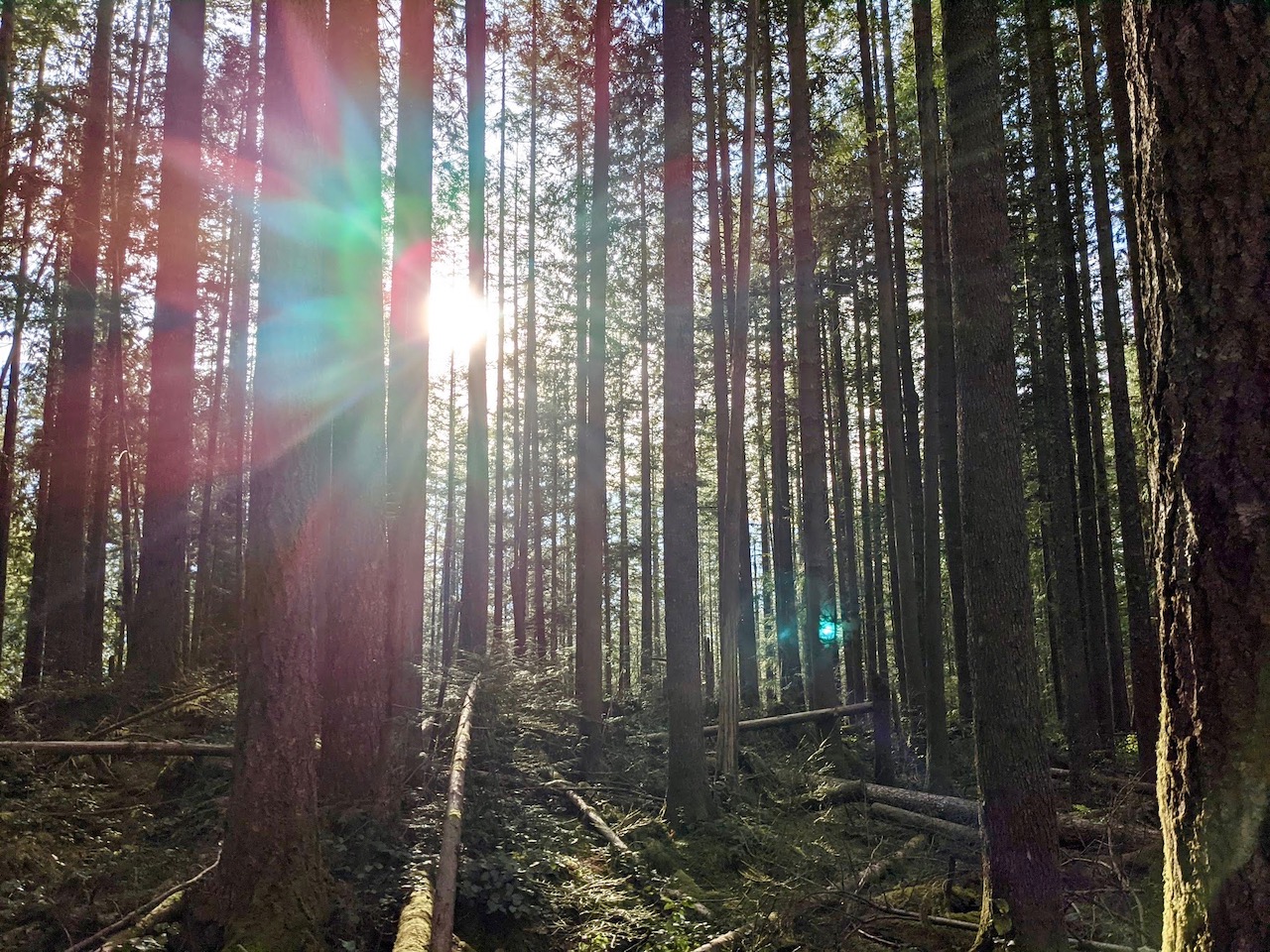
The wide trail led gradually uphill, surrounded by big lead maples and sword ferns. The path was peppered with fallen leaves, and even a few fallen trees from a recent windstorm. We probably encountered four blowdowns across the trail, although none were too difficult to cross. Cougar Mountain Park is well-maintained, so I expect these blowdowns will soon be removed.

After about half a mile, we came to the intersection with the Coal Creek Falls Trail. All trail junctions are well-signed at Cougar Mountain Park, but I still recommend bringing a map with you, whether an online trail map (like AllTrails) or a photo of the one posted at the trailhead. Unless you’re very familiar with the trail system, the trail names won’t mean much. Having a map also enables you to easily change plans if you decide to try a longer or shorter route.

We turned onto the Coal Creek Falls Trail, winding down a narrow path into the gully. Although this trail isn’t as broad as the Cave Hole Trail, it’s still easy to follow. It’s a bit steeper than the other trails we hiked, but nothing extreme. The highlight is the beautiful ravine at the base of Coal Creek Falls, where a new footbridge, smelling of freshly cut cedar, crosses the creek.

I have to say, Coal Creek Falls itself is not exactly impressive. Despite all the recent rain, the waterfall was a mere trickle of water running over the rocks. Regardless, this is an undeniably lovely spot to take a break and soak in the surrounding forest.

From Coal Creek Falls, we wound our way up to the Quarry Trail, then turned left to continue. Another blowdown crossed the path, but we navigated it with ease. At this junction, you can also head right to return to the trailhead. We wanted a little more hiking, so chose to extend our route further into the park.

The Quarry Trail led further uphill. To our left, we glimpsed the ravine below, overflowing with ferns and salal. Overhead, golden-hued vine maple leaves dappled the sky. This is what I love about fall hikes in the Northwest — the vibrant greens and yellows, the cool damp air, and the slow pace of a lingering walk in the woods.

At the top of the Quarry Trail, another sign showed us our options. We could go back down the trail to Coal Creek Falls, or turn onto Fred’s Railroad Trail. Our goal was to check out the “Cave Hole” for which Cave Hole Trail was named, so we turned left onto Fred’s Railroad Trail. A wide, level path led to another intersection pointing the way toward Cave Hole.

As it turns out, there isn’t much to see at Cave Hole. The large hole is largely overgrown with ferns and vines, and a fence bars hikers from getting too close. Apparently, it’s for our own protection, and I have to say that the possibility of ground collapse or fatal gasses sounds, well, a wee bit threatening. Intentionally so, I presume. Good hikers that we are, we heeded the sign’s warning.

As we continued down the Cave Hole Trail, we passed the turnoff for Coal Creek Falls once more. We were back on familiar ground for the final half mile of our hike. Familiar though it was, there were still a few surprises in store. As we neared the parking lot, I caught a glimpse of something unexpected through the trees. Just off the trail in a small, boggy clearing, a curious structure appeared. Six-year-old T was eager to investigate, and gave the forest hut his full approval.

Back at the trailhead, we said goodbye to our friends before heading for our car. In little more than half an hour, we were back at home ordering Szechuan food for dinner. A good hike, good friends, and good food — it was an excellent way to finish the weekend.


